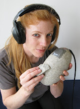
 Q: What is your call sign?
A: We have to pick a new call sign each time we go out in a Zodiac. This is often a challenge as it turns out that neither Oona nor I seem to be particularly good at coming up with these. Often we end up standing around the Mustang Jacket room all ready to go but lacking an appropriately pithy and witty name. A couple ones we have used so far are: Baby Steps (our first trip without a chaparone), Rerun (returning to Old Palmer Island), and 3 Musketeers (boating with Louise). Yesterday's call sign was Beach Bunnies. It was so sunny and warm that, as long as I stayed out of the wind, I could almost imagine being outdoors in a bathing suit. I did at one point actually get hot and took off two of my fleece jackets.
Q: How close can you get to the Piedmont?
A: It depends on where exactly. There is an area of the Marr Ice Piedmont (aka the glacier) behind the station that we are allowed to roam freely on which has been probed for crevasses and whose borders are marked by black flags. It is not safe to wander beyond the flags without being roped up and skilled in glacier travel and crevasse rescue. In a couple of days Oona and I will likely be hiking out onto the Piedmont beyond these boundaries with some members of Palmer's GSAR (Glacier Search and Rescue) team to do some recordings inside crevasses (me) and crevasse photography and sketching (Oona).
 Much of the rest of the edge of the Marr Ice Piedmont is calving into the ocean in our area. Several times each day we hear loud pops, rumbles and booms as seawater undermines towering ice seracs and cliffs, and sections come crashing down. Here is a picture of some large ice chunks that fell earlier today. The cliff here is probably over 150 feet tall. As the ice melts back, bit by bit more rocky pieces of land are revealed. New edges of Anvers Island have emerged even over the 3 weeks that I have been here. Or, maybe it will turn out that these are not the shores of Anvers Island at all, but edges of new islands instead. Where Anvers is still covered in ice all the way down to the ocean, we don't yet know its true boundaries. The land that Palmer Station is built on may even turn out to be a smaller separate island. But, I digress, when we are boating around the edge of the glacier for safety reasons we are supposed to stay 300 meters from it.
Q: How deep can you see into the water? How deep is the water at its deepest?
A: The water here has a lot of glacial silt in it, which gives it that pretty turquoise blue color, but severely limits underwater visibility. I'd say maybe I can see down 10 feet. As for the depth of the ocean here, I just looked it up on a nautical chart downstairs. The deepest area I could find a sounding for within Palmer's safe boating limits is around 39 fathoms (234 feet).
Q: If it's summer, does it ever get completely dark? Is the sun spinning around you?
A: The sun does set here, but these days only for about 5 hours and then it comes up again. So, it never gets completely dark, just a murky twilight and then it starts getting light again. Last night I was up until 2am recording Elephant Seals and I didn't end up needing the headlamp I had brought with me. The sun doesn't spin around us like it would do at the South Pole, but it is in the north, which is weird for me.
This is moonrise last week at around 11:30pm

Q: Is there anything like northern lights in Antarctica?
A: Yes, the Aurora Australis, but we can't see them here now because it doesn't get dark enough.
Q: Are you the greatest martial arts master in all of Antarctica?
A: After watching the Southern Elephant Seals sparring in the water last night for about 5 hours I think not. What a strange and beautiful thing!

No comments:
Post a Comment